
The Jack Tennant Memorial Bridge officially opened October 15, 2020. The new bridge and the arterial road connections includes on-street bike lanes and a separated, parallel 3 metre-wide multi-use pathway.
The extension of James Walker Trail from Riviera Way through to Highway 22 will be constructed later, depending on the timing of the South Bow development.
- Missed the event?
- watch the video on Urban Casual (Facebook)
- watch the highlight video (YouTube)
About Jack Tennant
Council voted April 8, 2019 to approve Jack Tennant Memorial Bridge as the name of Cochrane’s new bridge.
Jack Tennant was one of Cochrane’s most involved residents who dedicated his life to building bridges between people and communities. He was the founder and publisher of the Cochrane Eagle, a photojournalist, columnist, involved AA community member, committed philanthropist and honourary member of the Stoney Nakoda nation. Tennant died in 2018.
Construction info
- Information Update: Gravel Pit Relocation (PDF)
- Information Update: Fish Habitat Construction (PDF)
- Construction Videos
Bridge details:
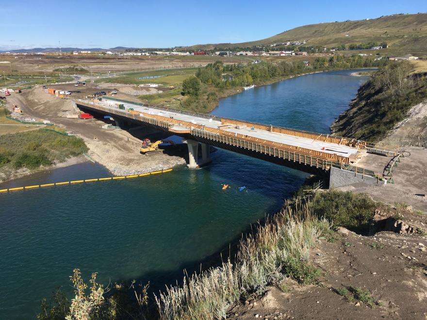
- three spans, about 160m in total length
- the deck is about 14m above the normal water level in the river at its highest point
- the deck is inclined up from the arena side toward the east at 3%
- two 3.5m-wide traffic lanes with a 1.5m-wide bike lane on each side
- 3m-wide regional pathway on the south side of the bridge separated from the traffic by a solid concrete barrier
Major construction materials:
- total mass of the steel plate girders = about 500,000 kg
- total mass of rebar = about 250,000 kg
- total volume of concrete = about 1,750 cubic meters
Description
The Jack Tennant Memorial Bridge opened on schedule Oct 15, 2020. This second crossing over the Bow River is a critical priority for the Town of Cochrane and Town Council and is part of a bigger project to connect the north and south sides of Cochrane.
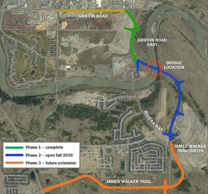
- Phase one: reconstruction of Griffin Rd from Griffin Industrial Pt to Spray Lake Sawmills Family Sports Centre (SLSFSC). Completed in 2018.
- Phase two: connection from SLSFSC to the new bridge to River Heights Dr, including roundabout connections to future developments. On time to be completed fall 2020.
- Phase three: extension of James Walker Trail from River Heights Dr to Southbow, in conjunction with the Southbow Landing development. To be scheduled
This map shows the general location of the new bridge and alignment of the proposed James Walker Trail corridor (alignment will be finalized as part of the ongoing detailed design).
The bridge is being designed as a three-span bridge with a single pier in the river, and the second pier adjacent to the river. The outer spans will be about 51m (165 ft) each with the central span being about 58m (190 ft). The piers have been designed with two columns to improve visibility for users beneath the bridge and the overall bridge aesthetics.
Video rendering
Conceptual rendering of the bridge at its actual location and design elevation.
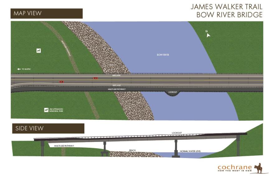
Conceptual illustration of the bridge design. In addition to two traffic lanes, the bridge includes bike lanes and a separated, 3 metre-wide multi-use pathway. A large lookout area above the eastern pier can be used to by cyclists and pedestrians to enjoy the view of the river.
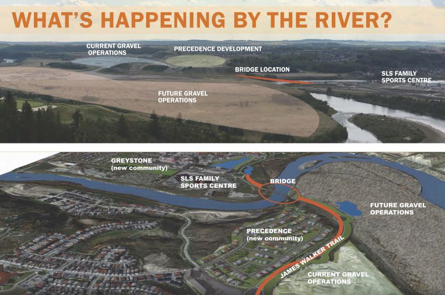
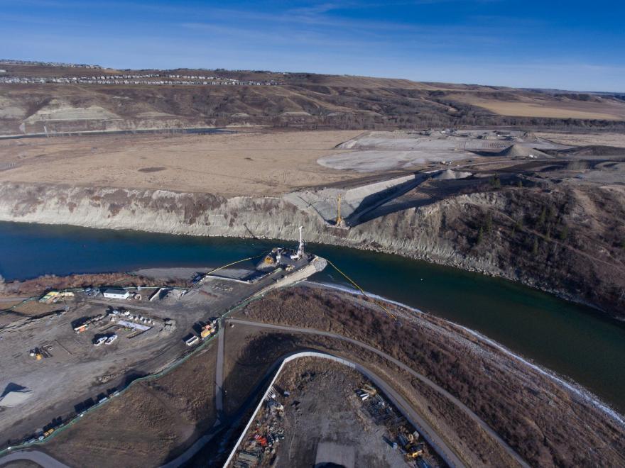
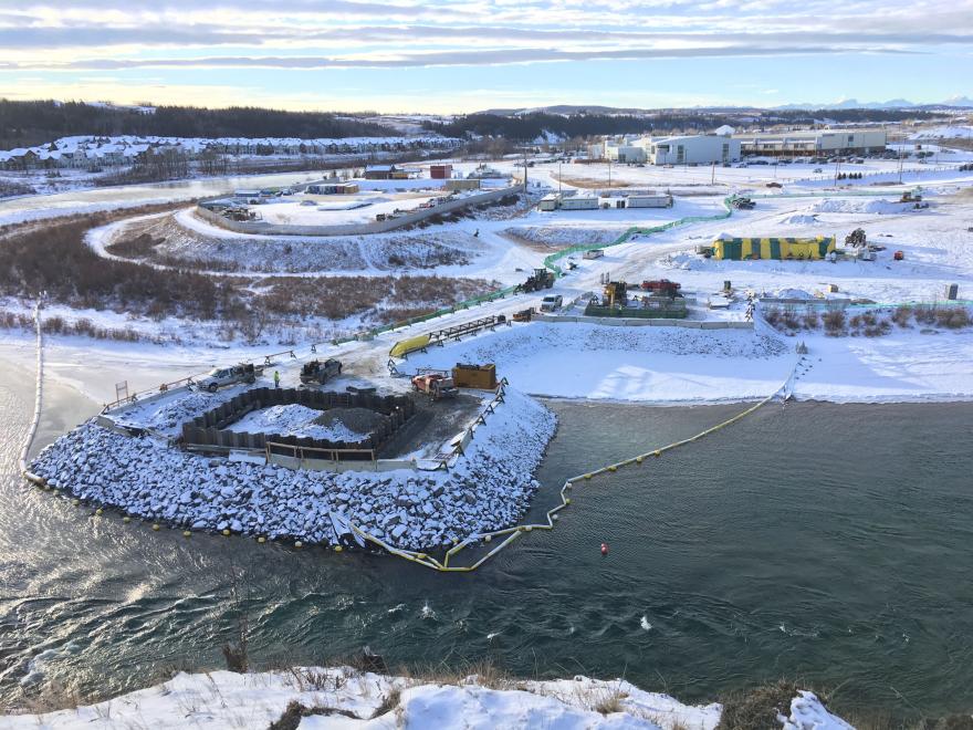
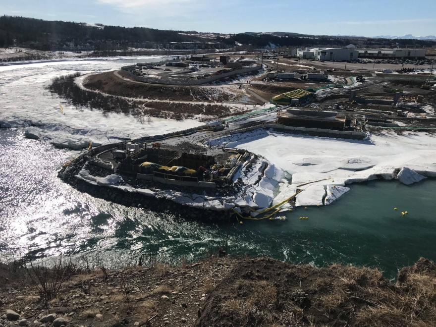
The south side of the Bow River is experiencing significant changes: stripping and grading for Precedence (new community), the start of bridge construction, the relocation of gravel pit operations and preparation for the new gravel extraction area.
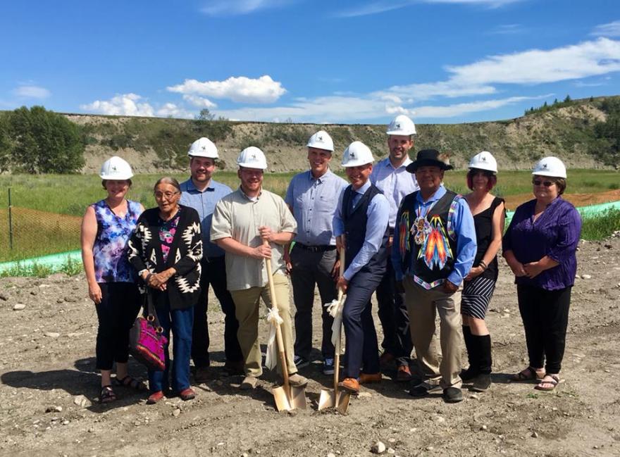
(l-r) Coun. McFadden, Bearspaw elder Irene Baptiste of Stoney Nakoda First Nation, Coun Nagel, Banff-Cochrane MLA Westhead, Coun Reed, Mayor Genung, Coun Wilson, Tsuut’ina spiritual spiritual leader Hal Eagletail, Coun Fedeyko, Coun Flowers.
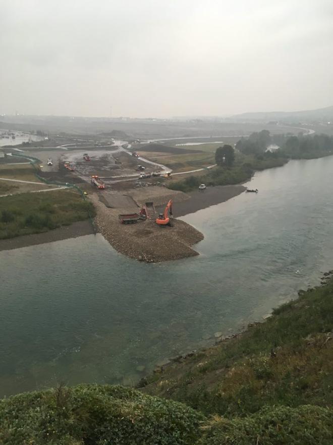
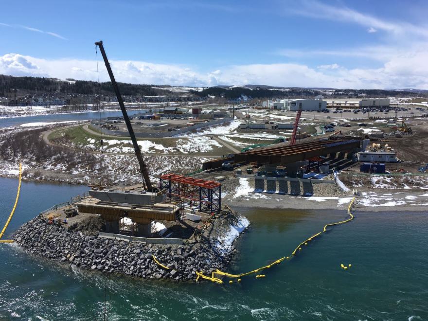
Start of construction of the in-river berm that will be used as a construction platform for the east pier of the bridge.
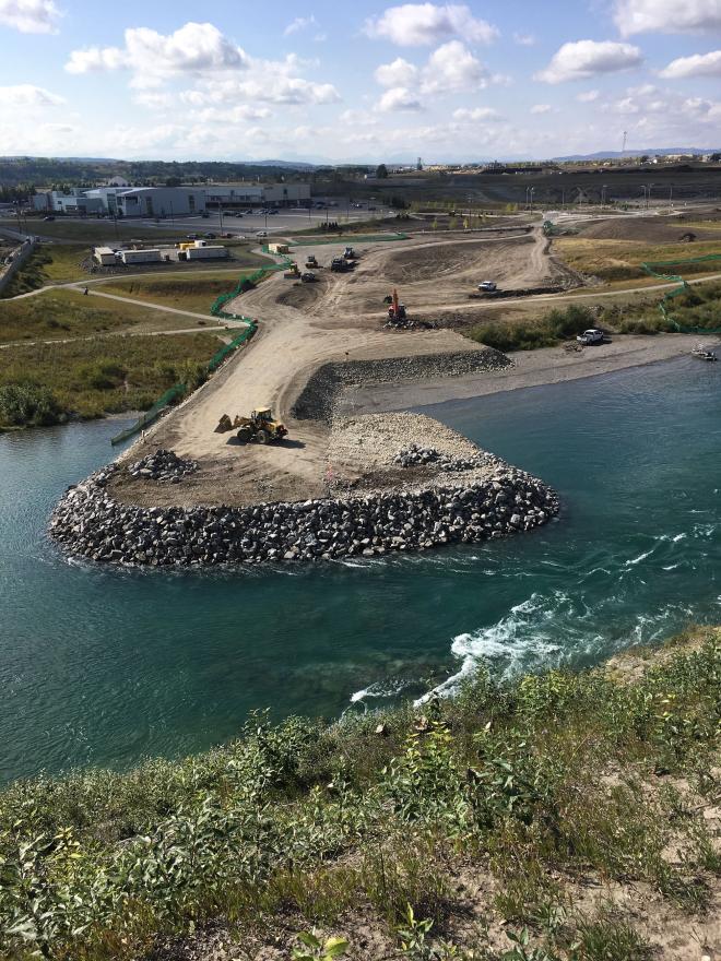
Construction of the temporary berm is complete (approx. 9500 m3 of cobbles). The berm will be used as a construction platform for the bridge piers and will be completely removed in summer of 2019 so the gravel beach can be reestablished.
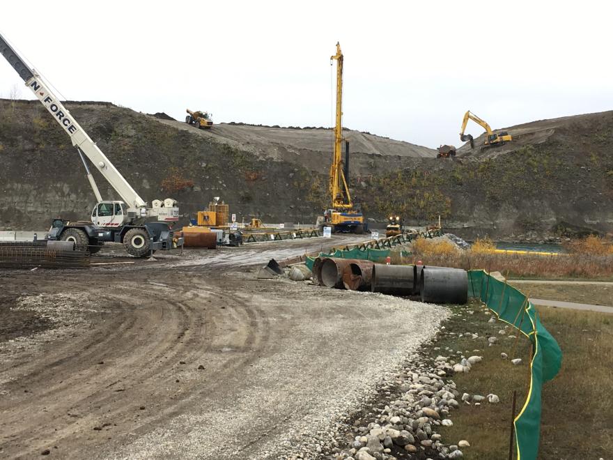
Construction start of in-river pier foundations. Each one consists of eight drilled-shaft, cast-in-place concrete about 1.2m (4ft) in diameter and up to 13m (43ft) long.
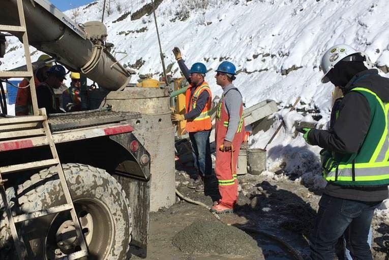
The first concrete for Cochrane's new bridge was poured on October 3, 2018 at 2:30pm.
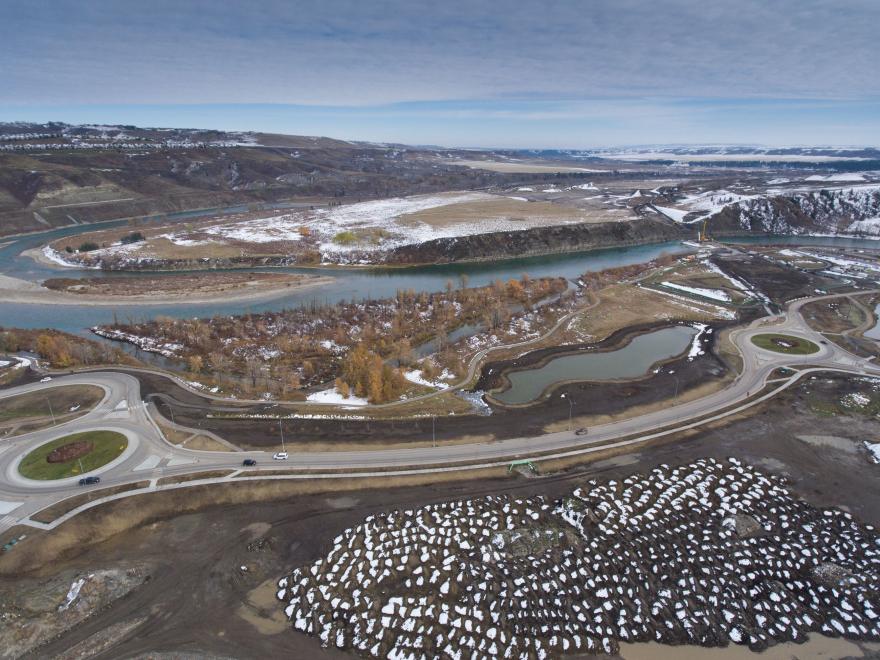
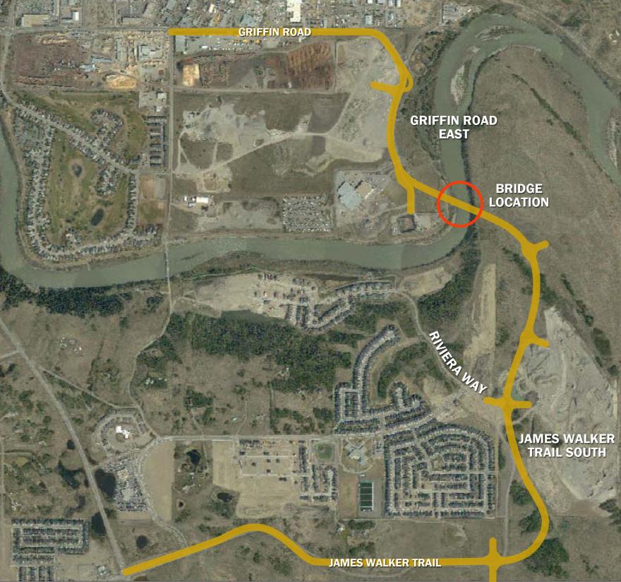
This photo shows how the new Griffin Road realignment project connects to the bridge and new James Walker Trail across the river.
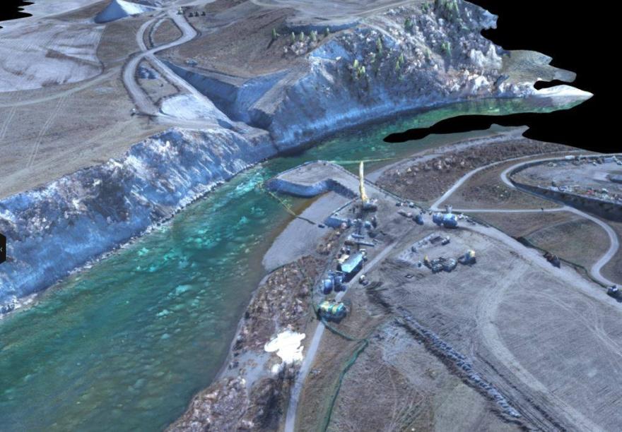
Image generated with drone-based orthographic photogrammetry. PCL Construction uses a Matrice 210 Unmanned Aerial Vehicle (UAV) from DJI and SiteScan cloud platform from 3D Robotics, Inc. (3DR) to process the imagery into the 3D model.
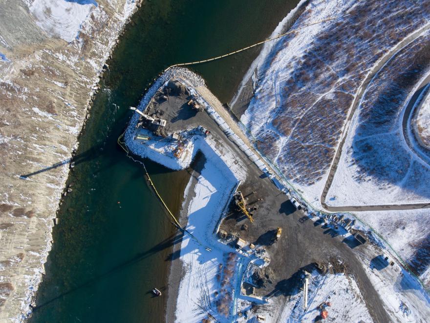
Orange tarps (bottom right): completed west abutment foundations. Yellow drill rig: foundations for the west pier. White drill rig: sheet pile cofferdam at the east pier pile cap. Snow-covered platform (top left): east abutment.
Drilling for the east abutment foundations on the far side of the river: the last 7 of 30 drilled shafts. The form work for the west abutment also began Monday, allowing for some above-ground construction this week.
The west abutment formwork and rebar are ready for the first above-ground concrete pour (about 80 cubic meters of concrete in each). The alternating circular spots under the rebar are the drilled shaft foundations extending into the abutment.
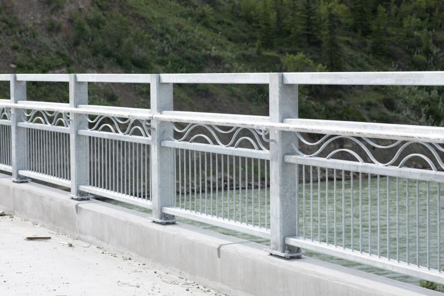
The bridge railings have been installed. What a great design!
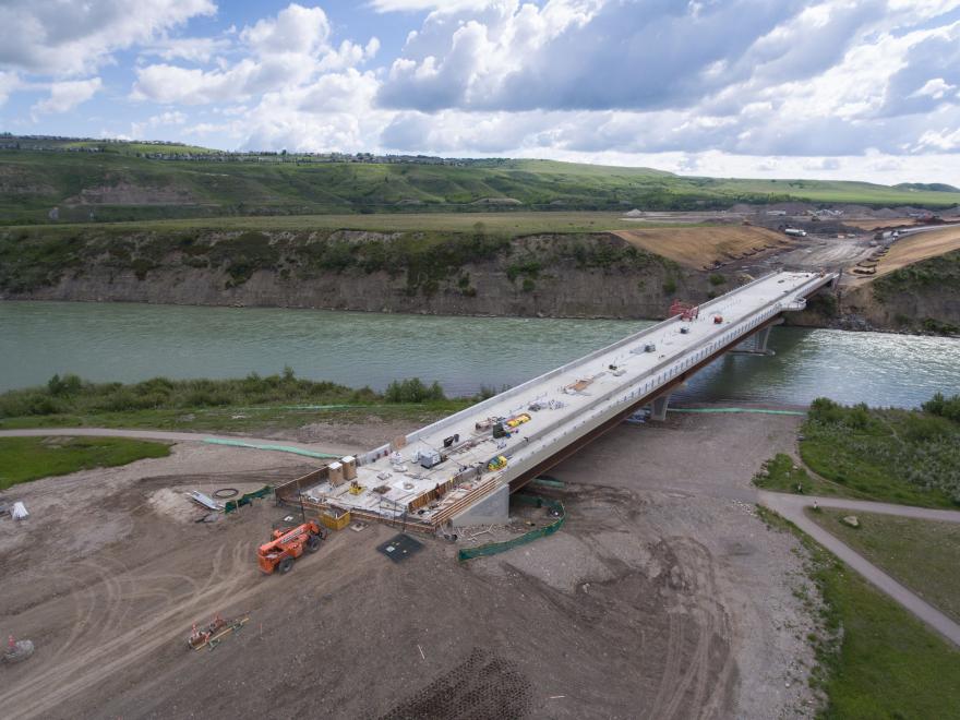
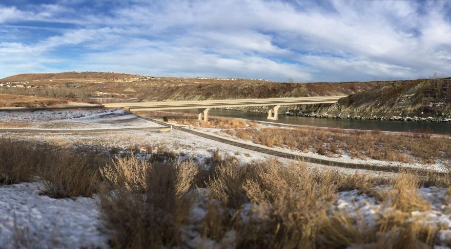
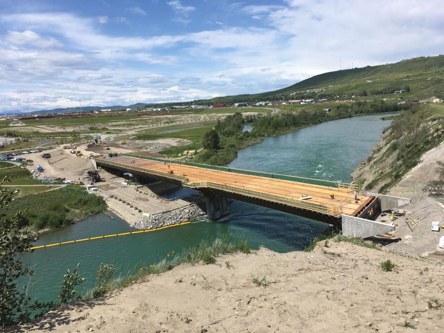
Aerial of bridge construction. Bridge is on schedule for opening fall 2020.
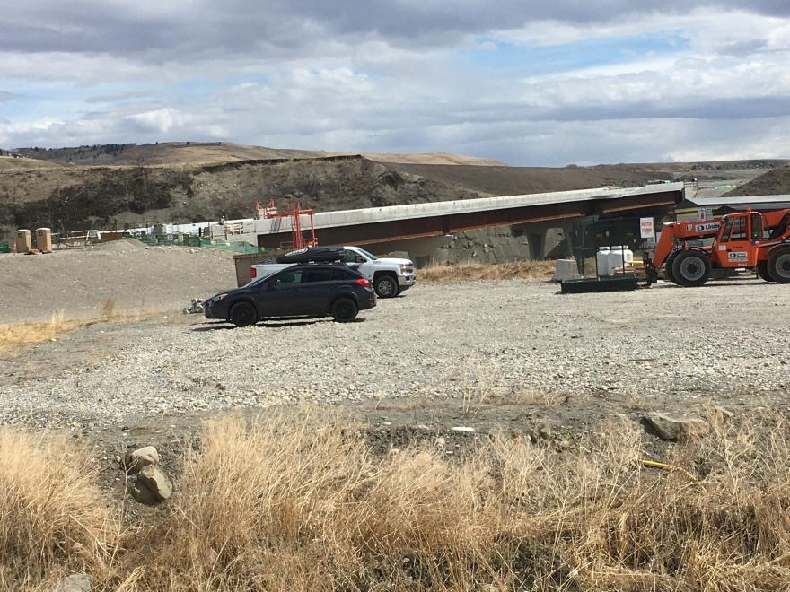
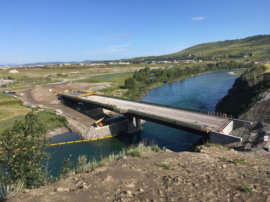
Construction of on the Jack Tennant Memorial Bridge is set to resume in the beginning of May. The construction will include completion of the approach slabs and paving of the deck. The railings will also be installed starting at that time.
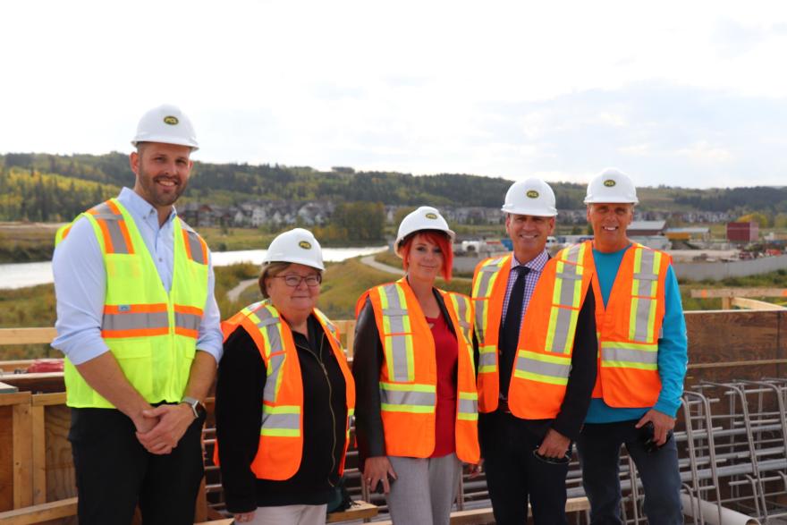
Members of Cochrane Town Council pose on the Jack Tennant Memorial Bridge
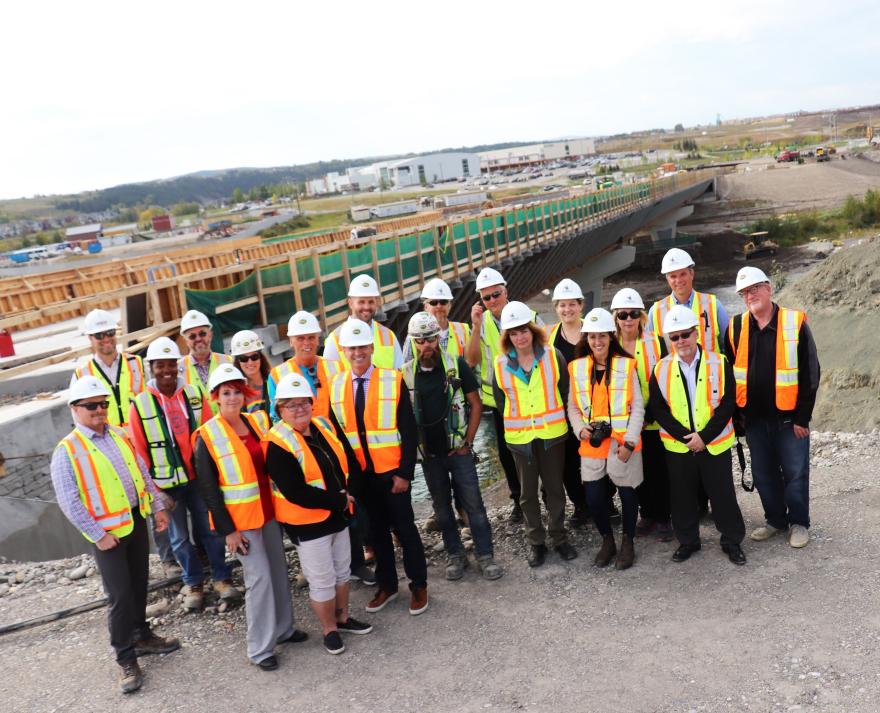
Mayor, Council and Town of Cochrane Senior Leadership Team pose on south side of the Bow River bank after crossing the bridge.
In-water berm being removed - Sept. 12, 2019
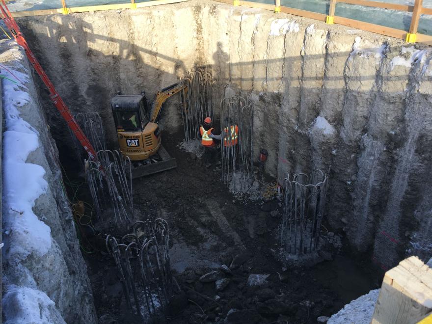
Inside the west pier secant pile coffer dam, about 1.5m below the river’s normal water level. In preparation for west pier pile cap, workers are cleaning the excess concrete off the rebar for the 1200mm drilled shaft foundations.
The sheet pile wall for the east pier cofferdam is complete. In the background: tarped-in west abutment and the west pier cofferdam.
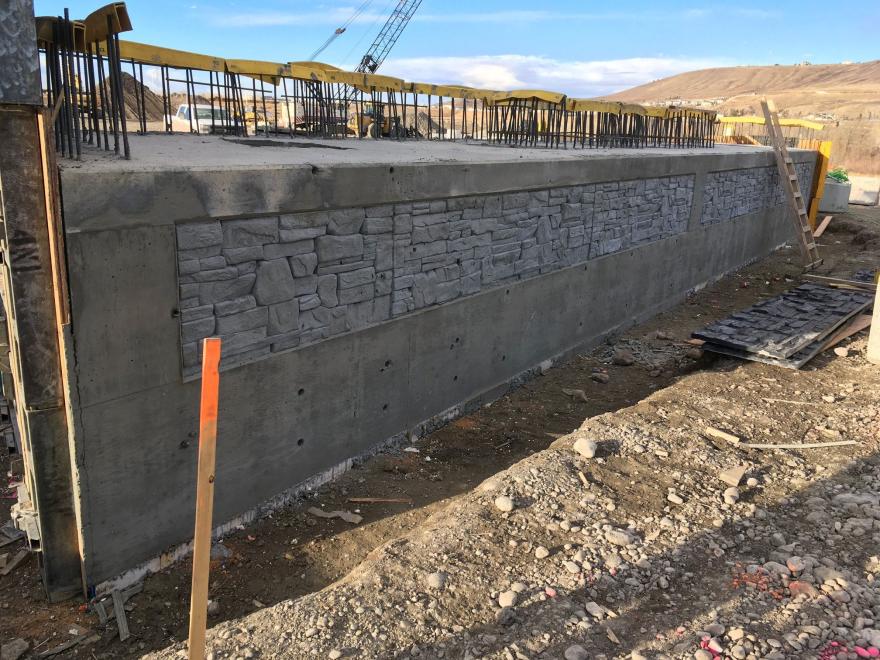
The form work for the west abutment seat, which was the first above-ground concrete pour, was stripped on Tuesday.
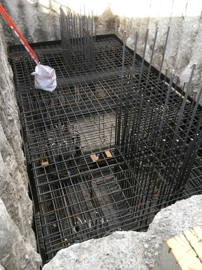
The rebar for the west pier pile cap is almost complete, with the concrete pour planned for before Christmas.
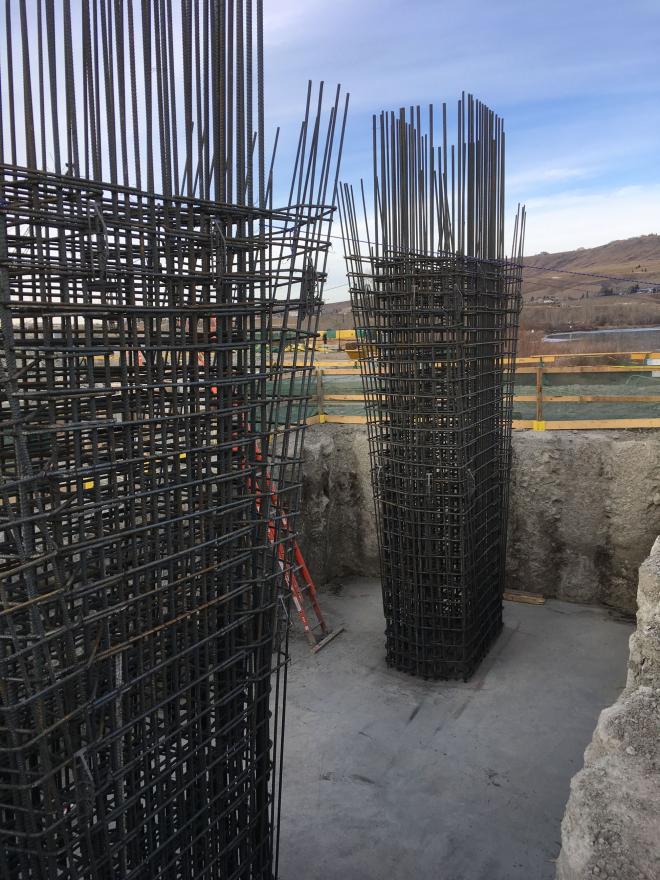
The pile cap for the west piers was poured before Christmas and has cured sufficiently to erect the rebar cages for the main piers. The formwork will now be placed around the rebar in preparation for the concrete pour.
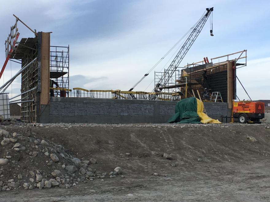
The west abutment wing walls are partially formed with the rebar almost complete. The formwork will be closed up this week for the planned pour next week.
Parts of the bridge structure are now visible: abutments on both sides of the river, west pier and east pier pedestal. Work is underway above the water level; berm can be removed before the June high-water season as scheduled.
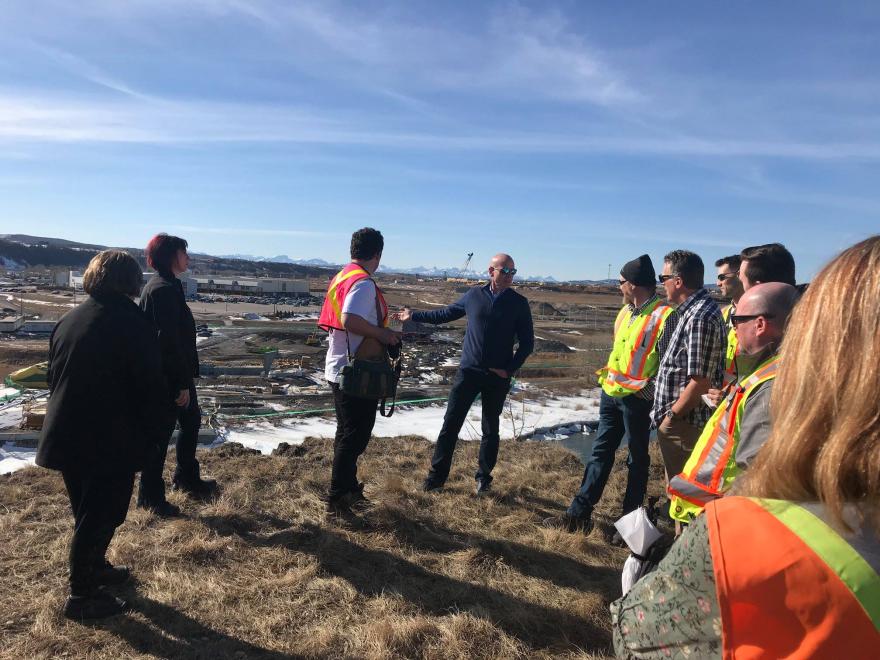
Mayor, Council and members of senior administration got a look at progress on bridge construction from the south side of the river today.
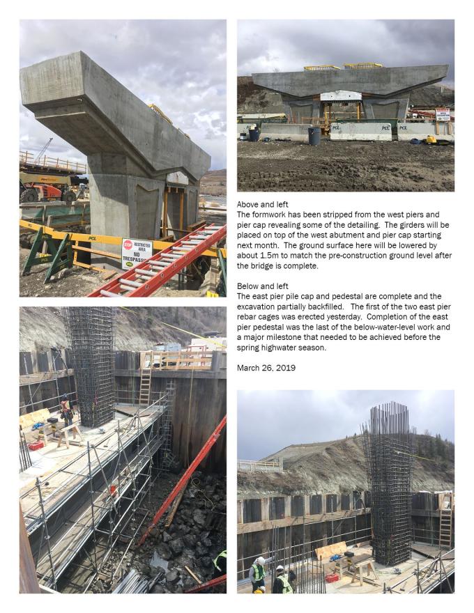
The east pier pile cap and pedestal complete and excavation partially backfilled. The first east pier rebar cage was erected. East pier pedestal was the last of the below-water-level work and a major milestone before the spring highwater season.
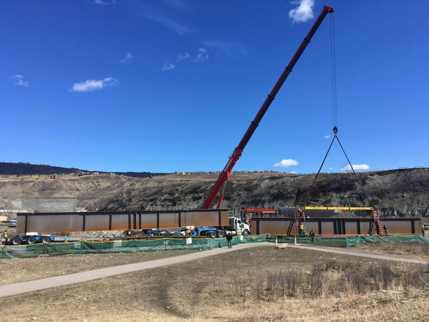
The first four girder segments (out of 25 total) arrived Sunday afternoon; two were hoisted onto the west pier today. The girder segments range between 28m and 37.6m long and weigh between 16,500kg and 22,100kg.
By the end of last week, we had received 12 of the 25 girder segments and hoisted 10 of them into place. We are scheduled to receive four more late this afternoon for hoisting into place later in the week.
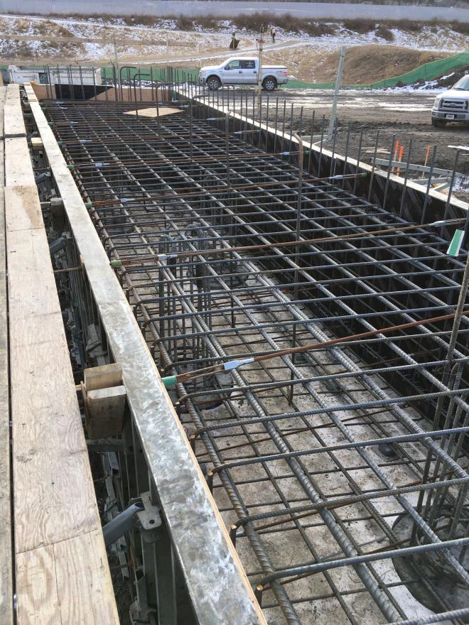
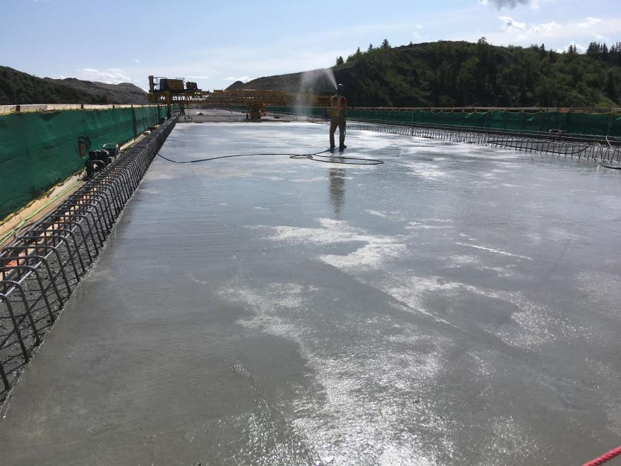
Crews are making good progress on the bridge since the installation of the girders. The west abutment is almost done and formwork for the deck is largely complete with the reinforcing steel starting to be placed. Concrete for the deck to be poured in Aug.